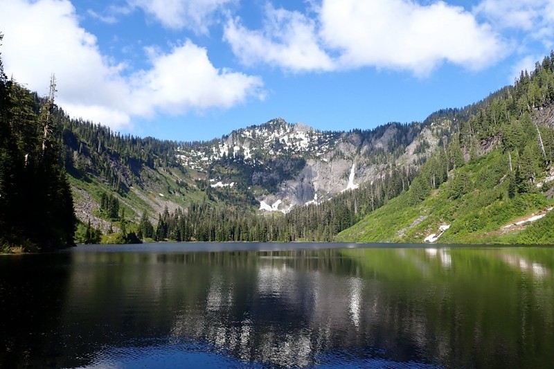
One of the More Obscure, and Difficult, Trail Runs That I Do
After a series of snow-related setbacks, I've been able to actually make it to my intended destination while trail running twice in a row. Two weeks ago it was Mason Lake (which is still covered in snow) and this week it was Marten Lake (which is not).
What makes this run interesting to me is that the last mile (technically, 1.1 miles, which believe it or not: every 10th of a mile matters in this one), is arguably the most difficult mile on any trail run I do. I think it compares very closely to Rainy Lake in this way, and I think it's safe to say they both have sections that are brutal, in terms of being steep, as well as dangerous.
Incidentally, here's a map of the route to Marten Lake:

I'm not exactly sure what was going on when I ran this one but two numbers jump out at me:
- The last mile, on the way up, took 21 min 49 sec.
- the first mile, on the way down, took 25 min 54 sec.
Those are both absurd, in terms of just taking way too long. That mile is the one closest to the lake, and is (a) difficult to follow (b) very steep (c) rocky & root-y ands (d) it has many impediments, like downed trees, to go over, under, or around.
I did get lost a number of times on the way down, and had to re-locate the trail (particularly as I got close to the Marten Creek bridge), but that 25:54 is odd to me .. I must've been dilly-dallying for it to take that much time.
- Garmin map & stats (there)
- Garmin map & stats (back)
I've run this three times now, so I went back and pulled the same numbers for comparison:
The "up" time is way more important to me, and clearly all of this running has been making me a more effective runner, but those down times really indicate to me just how steep and difficult this trail is.
Think about if for a minute: I'm running down a slope, as fast as I'm able, and still my time sucks. (It should be more like 12-14 minutes/mile).
Anyways, here are four photos of the ascent and the lake, and then I'll let you know why I'm writing about this particular run:
(Note those images are clickable)


I did make a composite image of the lake itself. Check it out (there's a download link below it):

Most people only see one view of Marten Creek, and it's a lackluster one. It's at the crossing of the Marten Creek bridge, which is approx 2.75 miles into the Otter Falls hike.
However, as it turns out, the creek has some really beautiful sections, most of which are effectively impossible to get to (there's this narrow granite chute near the bottom that funnels the entire creek into a supersonic torrent of water that I've never been able to get a good photo of because it's so difficult to get anywhere near it).
About a 1/4 of a mile from the lake is a section of the creek that you can get to. I marked my path with a bunch of trail markers so I could find my way back and explored a lovely section of the creek. It's all smooth granite, beginning with a 40' waterfall cascading down a huge rock face and ending in some frothy rapids as the creek disappears over what I suspect is another waterfall.
I did scramble up to the 40' granite face. The last photo in the gallery below is standing right in front of it.
Here are some of the images I took .. they're all clickable for their hi-rez versions:


I took a couple of short videos. This BLOG is hosted on a fairly weak server, so be patient if you pull these down:
- (video #1) 250MB, 65 second duration
- (video #2) 200MB, 55 second duration
- (video #3) 190MB, 50 second duration